Video Library
Album: Paleo-Satellite Views
Satellite imagery and visualization software like Google Earth have changed how people explore and learn about the earth. With this series of animations, we wanted to simulate what it might look like if we had satellite imagery of ancient landscapes from hundreds of millions of years ago.
-

Colorado Laramide Highlands at 60 million years

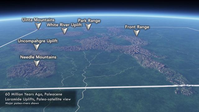
Colorado Laramide Highlands at 60 million years
This animation shows the State of Colorado about 60 million years ago during the late Paleocene. The high mountains associated with the Laramide Orogeny are annotated, as well as the approximate locations of the known rivers.
The video demonstrates two concepts: (1) the distribution of high mountains of Colorado had some similarities to the high areas today, and (2) Colorado had a more extensive flora during the late Paleocene (60 Ma).
Map is based on the reconstruction of the Laramide highlands by Tweto (1980). Distribution of flora is based, in part, on the input of Kirk Johnson. A special thanks to Vince Matthews (retired State geologist) for technical input.
Animation by Joseph Rogers, James Adson, and Paul Weimer.
Geologic age: 60Ma -
Pennsylvanian Paleo Satellite View of Colorado 312 Million Years Ago
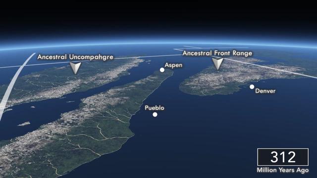
Pennsylvanian Paleo Satellite View of Colorado 312 Million Years Ago
312 million years ago, most of North America was under water. The Ancestral Rocky Mountains rose high above the sea, and braided rivers formed narrow coastal plains. The Maroon Formation, which makes up the famous Maroon Bells, and the Fountain Formation, which makes up Boulder's Flatirons, were deposited in this coastal environment.
This animation is part of a series of "paleo-satellite" views that show what Colorado might have looked like if satellite imagery was available millions of years ago.
Geologic age: 312Ma -
225 Million Years Ago: Triassic Paleo-satellite View of Colorado
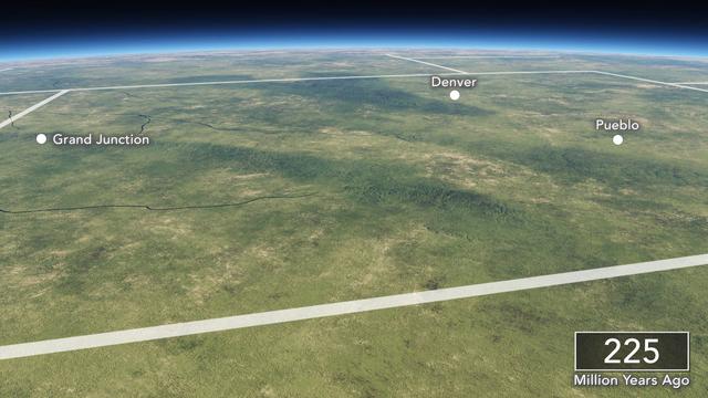
225 Million Years Ago: Triassic Paleo-satellite View of Colorado
225 million years ago, Colorado had a temperate climate and was covered with forests unlike anything found on earth today.
This animation is part of a series of "paleo-satellite" views that show what Colorado might have looked like if satellite imagery was available millions of years ago.
Geologic age: 225Ma -
150 Milion Years Ago: Late Jurassic Paleo-satellite View of Colorado
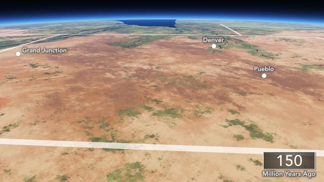
150 Milion Years Ago: Late Jurassic Paleo-satellite View of Colorado
150 million years ago, during the late Jurassic, Colorado was a flat and arid region. The Ancestral Rocky Mountains had been eroded flat, and large river systems existed in some areas. The fossil-rich Morrison Formation formed from sediments deposited during this time.
This animation is part of a series of "paleo-satellite" views that show what Colorado might have looked like if satellite imagery was available millions of years ago.
Geologic age: 150Ma -
280 Million Years Ago: Permian Paleo-sattelite View of Colorado
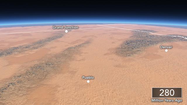
280 Million Years Ago: Permian Paleo-sattelite View of Colorado
280 million years ago, during the Permian, Colorado sat in the middle of a vast desert. The Ancestral Rocky Mountains formed highlands, and the low-lying areas were filled with fields of sand dunes. In the Front Range area, these dunes became the Lyons Formation.
This animation is part of a series of "paleo-satellite" views that show what Colorado might have looked like if satellite imagery was available millions of years ago.
Geologic age: 280Ma -
200 Million Years Ago: Early Jurassic Paleo-satellite View of Colorado
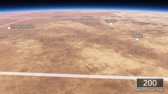
200 Million Years Ago: Early Jurassic Paleo-satellite View of Colorado
200 million years ago, Colorado was a barren desert. The Ancestral Rocky Mountains were still present, but erosion had greatly reduced their topographic relief.
This animation is part of a series of "paleo-satellite" views that show what Colorado might have looked like if satellite imagery was available millions of years ago.
Geologic age: 200Ma